0
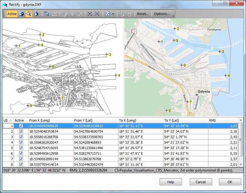
专业的桌面GIS支持大多数(和其他)数据格式,企业空间数据库,5,000个预定义的坐标系以及用于自定义和功能扩展的内置脚本IDE。
分类目录

具有任何许可的所有平台的TatukGIS Editor替代品
12
ArcGIS
ArcGIS是地理信息系统(GIS)软件,用于可视化,管理,创建和分析地理数据。
8
5
3
Spatial Feature Server
MapET的Spatial Feature Server是ESRI Geoservices REST实现,可与所有ESRI Rest API一起使用。发布数据的来源是主要RDBMS的空间扩展,例如Oracle,Microsoft SQLServer,MySQL,PostgreSQL。
- 付费应用
- Windows
1
0
GeoSheets
GeoSheets是Google Spreadsheets的免费附加组件,可轻松执行轻量级GIS任务,例如地理编码,地址归一化,距离计算以及创建自定义和可嵌入的地图。
- 免费增值应用
- Web
- Google Drive