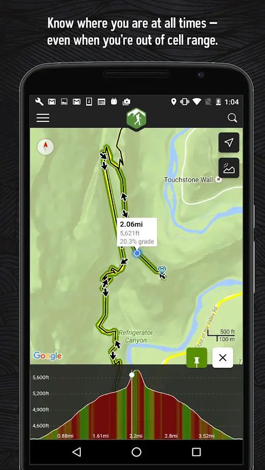
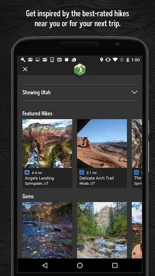
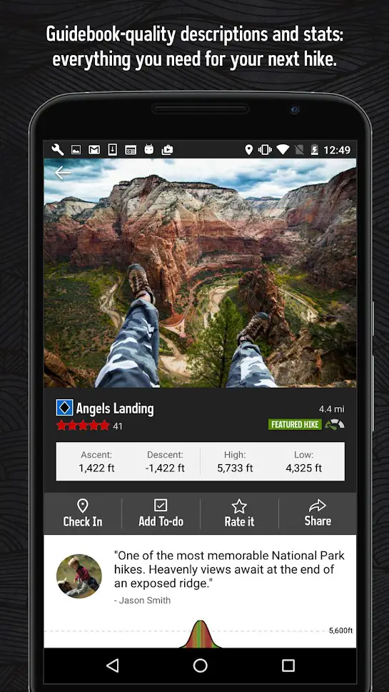
远足计划正在重新定义远足径地图和指南。就像打印的路线图一样,我们向您显示所有已知的路线。包括海拔剖面,完整的GPS路线,照片等。像一本指南一样,我们向您展示使用这些路径的最佳精选远足。重点,难点,要寻找的特殊功能,本地联系人,甚至是“虚拟远足”,因此您可以在解决之前先体验一下这条小径。
分类目录
具有任何许可的所有平台的Hiking Project替代品
5
4
Komoot
查找最佳的远足径和路线,查看地图,并与他们同在。探索十大最佳远足路线。
- 免费增值应用
- Android
- iPhone
- Apple Watch
- iPad
- Android Tablet
- Web
3
2
1
1
0